
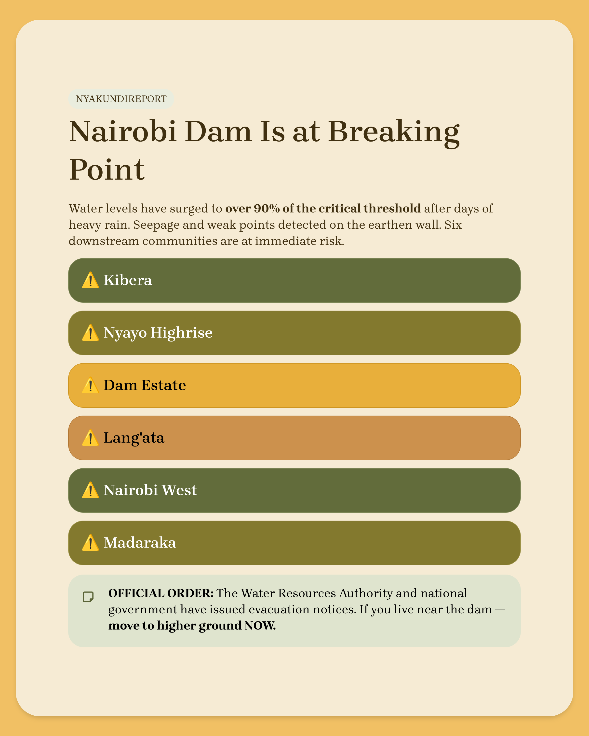


Water levels at Nairobi Dam have risen to dangerous levels after days of heavy rain, putting several downstream estates and informal settlements on high alert over possible flooding if the embankment gives way.
Authorities say the reservoir is now above 90 percent of its critical threshold, with visible seepage and weak points on the earthen wall, leaving little room for additional inflows.
Officials have listed six main areas at immediate risk: Kibera, Nyayo Highrise, Dam Estate, Lang’ata, Nairobi West, and Madaraka, all of which lie along the likely path of floodwaters in the event of an overtopping or partial breach.

The Water Resources Authority and the national government have issued evacuation notices, urging residents in the most exposed zones, especially villages in Kibera closest to the dam, to move to higher ground as a precaution.
On the ground, however, there has been resistance and anxiety, with many informal‑settlement residents saying they understand the danger but lack alternative shelter or support to relocate safely.
The scare comes amid wider flash floods in Nairobi that have submerged homes, damaged roads, and strained water and sewer infrastructure across multiple estates.
Years of siltation, encroachment, and poor maintenance have reduced Nairobi Dam’s capacity and weakened its structures, turning it into a high‑risk chokepoint under extreme weather.
Experts argue that while urgent evacuation support is essential now, the city must also treat the dam as critical safety infrastructure investing in dredging, repairs and proper buffer zones to avoid facing the same life‑and‑death risk every rainy season.
ALSO READ: Former Kirinyaga Senator Daniel Karaba Dies